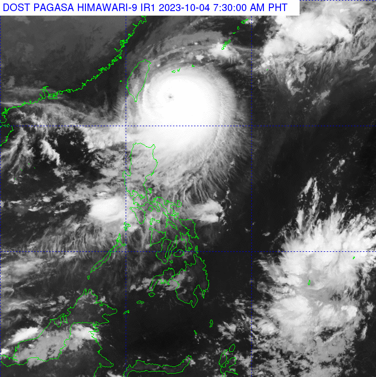
SYNOPSIS: At 3:00 AM today (04 Oct 2023), the center of the eye of Typhoon “JENNY” {KOINU} was estimated based on all available data at 275 km East Northeast of Itbayat, Batanes (21.9°N, 124.2°E) with maximum sustained winds of 150 km/h near the center and gustiness of up to 185 km/h.
It is moving West Northwestward at 10 km/h. Southwest Monsoon affecting Central Luzon, Southern Luzon, and Visayas.

Forecast Weather Conditions
Batanes and Babuyan Islands – Stormy due to typhoon Jenny. Possible flooding or landslides expected due to moderate to heavy rains. Minor to moderate threat to lives and properties due to strong winds.
Mainland Cagayan, Isabela, Apayao, Kalinga, Abra, and Ilocos Norte –Rains with gusty winds owing to typhoon Jenny. Possible flooding or landslides due to moderate to heavy rains. Minimal to minor threat to lives and properties due to strong winds.
The rest of Cagayan Valley, the rest of Cordillera Administrative Region, and the rest of Ilocos Region — Cloudy skies with scattered rainshowers and thunderstorms. Trough of typhoon Jenny. Possible flash floods or landslides due to moderate to at times heavy rains.
Zambales, Bataan, Occidental Mindoro, and the northern portion of Palawan — Occasional rains due to Southwest Monsoon. Possible flash floods or landslides from moderate to heavy rains.
Metro Manila, CALABARZON, the rest of Central Luzon, and the rest of MIMAROPA — Cloudy skies with scattered rainshowers and thunderstorms due to Southwest Monsoon. Possible flash floods or landslides due to moderate to at times heavy rains.
The rest of the country — Partly cloudy to cloudy skies with isolated rainshowers or thunderstorms from Southwest Monsoon and Localized Thunderstorms. Possible flash floods or landslides during severe thunderstorms.
(Jr Amigo/ai/mnm)


